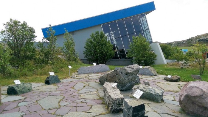
The Johnson Geo Centre in St Johns, Newfoundland, Canada
Author: Mike Smith, Director National Rock Garden
Extract from National Rock Garden Newsletter No. 14, September 2017
The Johnson Geo Centre is a magnificent educational facility, located within one of Newfoundland’s major tourist attractions, a high rocky lookout over the Atlantic Ocean called Signal Hill, which is close to the downtown area of the city of St Johns. The Geo Centre is directly associated with a popular area for families and visitors due to the many historical aspects of the location including:
- It is the site of the final battle of the Seven Years’ War in North America in 1762 – known as the Battle of Signal Hill, in which the French surrendered St. John’s to a British force under the command of Lt. Colonel William Amherst. Communication between land and sea took place here using flags from the 17th century until 1960.
- On 12 December, 1901, the first transatlantic wireless transmission by Morse code was received here by Guglielmo Marconi in an abandoned hospital, the transmission originating from Marconi’s Poldhu Wireless Station, Cornwall, UK.
- The headland has defensive installations related to U-Boat detection in World War 2. A professional group performs a Military Tattoo featuring early English soldiers, and then First World War soldiers (Newfoundland was then a British colony). A cannon, some old rifles and a machine gun were fired towards the end.
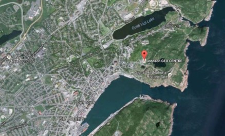
The Geo Centre is essentially an Earth Science museum, comprising:
- Multiple theatres showing both technical and nature programs
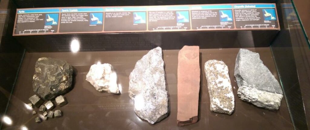
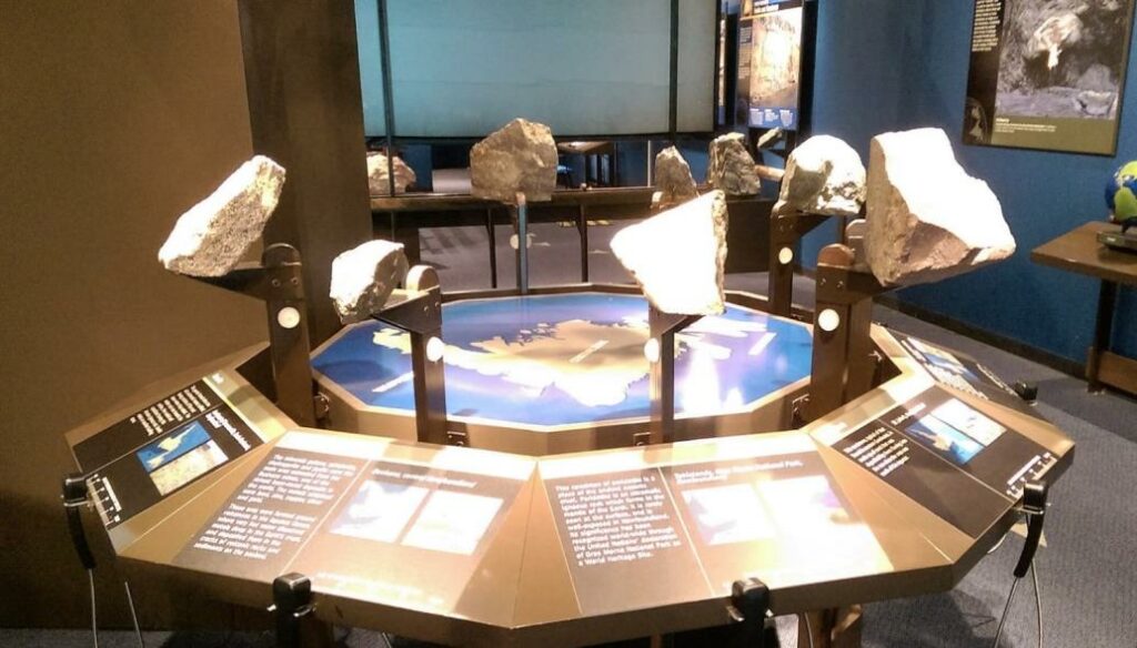
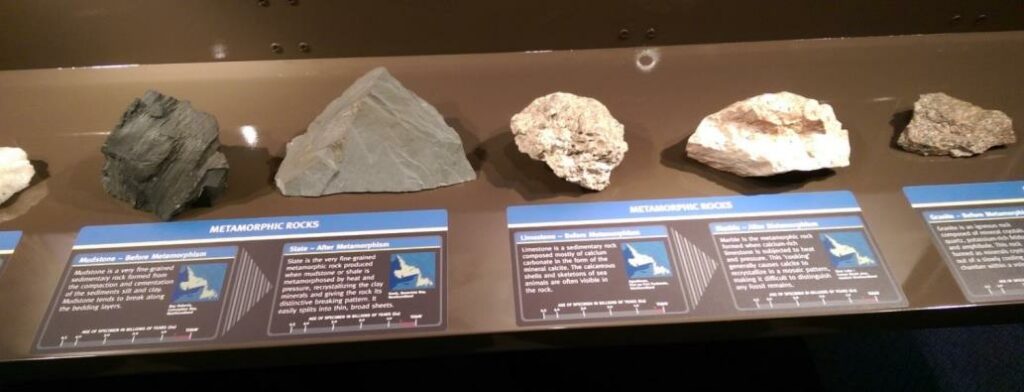
- A very complete display of rock and mineral specimens (mostly 5 to 50 kg in size, with several approaching 1 tonne in size
- Numerous poster displays on a wide range of topics, and
- An external display of larger half to 2 tonne rock specimens.
The essential makeup of the Geo Centre is quite different to Australia’s National Rock Garden, but we can learn from its methodologies in earth science education. It is highly recommended as a tourist attraction for anyone travelling around the eastern coast of Canada. All aspects of Earth Science are covered – from basic rock classification and rock evolution (equivalent to a ‘GEOLOGY 101’ university course), through to advanced rock structure, earth processes, planetary geology, natural hazards, as well as commercial uses of both minerals and hydrocarbons. The economic aspects of the geosciences are presented with a very positive perspective, balanced by realistic discussion of potential environmental damage.
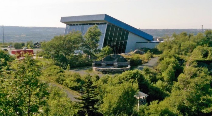
The building is quite a striking angular structure, as shown below, with easy driving access from the downtown area and with plenty of parking.
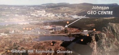
During the establishment of St Johns, this area was the site of numerous quarries, providing monumental stone from the Gibbett Hill Sandstone for many of the city’s major buildings.
Every visitor is immediately met by a staff member providing advice on the overall layout of the displays and news of the day’s activities. There is a specific display area for the oil and gas industry in Canada, which is sponsored by Exxon-Mobil. Another display room provides a highly convincing visual explanation of the disaster of the sinking of the Titanic. The facility contains a café and a souvenir shop. For the entertainment of small children, a small side room provides a separate play area, which has just a few geological themes incorporated.
The majority of the scientific displays are located underground, so the facility is operational in all weather conditions. At St Johns, maximum temperatures average from minus 1 in January to 20 degrees in July & August, with the corresponding average minima being -8 to 12 degrees. Significant snowfalls occur each month from November to April, but Canadians are masters of managing their severe winters.
Throughout the day, three options were available for watching movies, some very geological, some more oriented to family engagement. There are also two choices of guided tours throughout each day, provided by Geo Centre staff on particular geological topics.
The Geo Centre occupies the former site of a small glacial lake which had filled in and become a swamp. The mud and gravel was excavated to expose a long steep rock cliff which forms the eastern wall of the main display area. The surface of this wall of Ediacaran age (dated at 545–550 MY) shows many characteristics of the sedimentary rock including dipping strata, ripple marks, quartz veining (with rusting pyrite), faulting and of course glacial striations. One of the guided tours focuses totally on this wall.
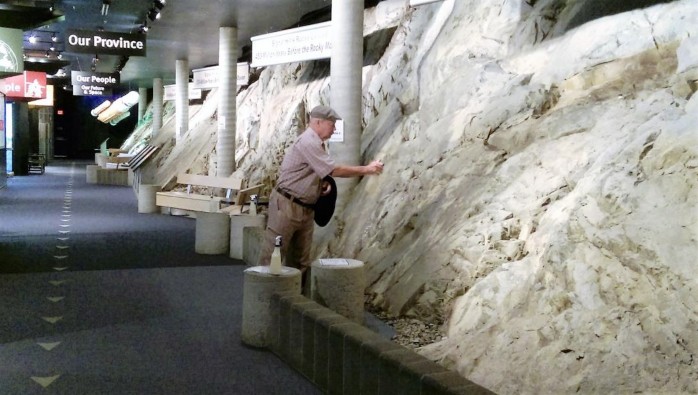
The labelling of all the displays is very clear (bilingual, of course) and simple enough for the general public, yet technically precise. There are several lecture theatres of various size, used either for talks, or for continuously rolling movies.

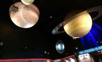
One of the many wide-ranging geological presentations features the intermittent materialisation of a crusty old “virtual geologist” as shown in the figure below. When a specific tour is announced over the speaker system, visitors are asked to gather beneath the planets in the main entry area.
The construction of the Geo Centre was funded entirely through the philanthropy of one local resident, Paul J Johnson (1928–2014). He was a highly successful businessman, who headed up an insurance company that started with one office in St Johns and grew to 40 offices across Canada. Johnson was not involved in mining or any other resource-related activity – it seems he wished to promote his home province of Newfoundland so he supported many projects. Operational funding for the Geo Centre was not provided by the Johnson family, so it is critical for income to be derived from everyday activities, as for our National Rock Garden. There are three main sources of funds:
- Entry fees, which are very modest and would not deter any visitors
- Public events, most notably weddings, using an open area adjoining the centre
- Overnights stays, which may be educational or just fun.
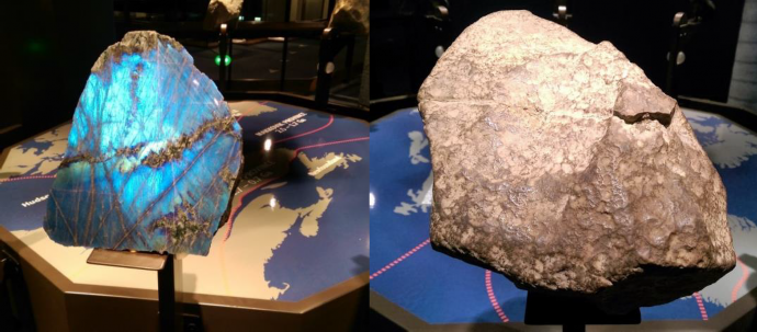
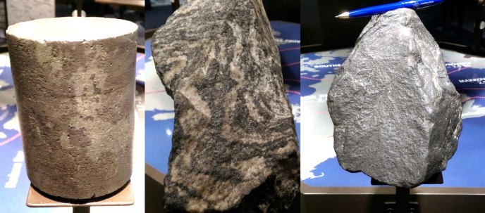
Another effective display labelled ‘Travelling Continents’ explained the principles of plate tectonics and distribution of the lithospheric plates of the Earth.
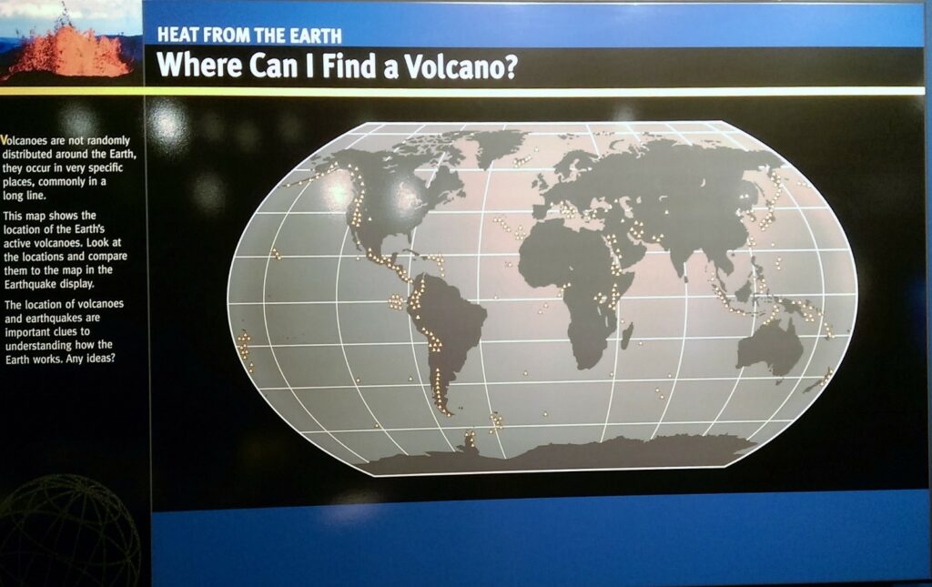
The devastating impacts of geohazards (such as the 1929 Burin Peninsula tsunami disaster) were dramatically portrayed in posters. Designed for young children, the opportunity to create your own earthquake and observe “real-time seismic activity” proved tempting for adults as well.
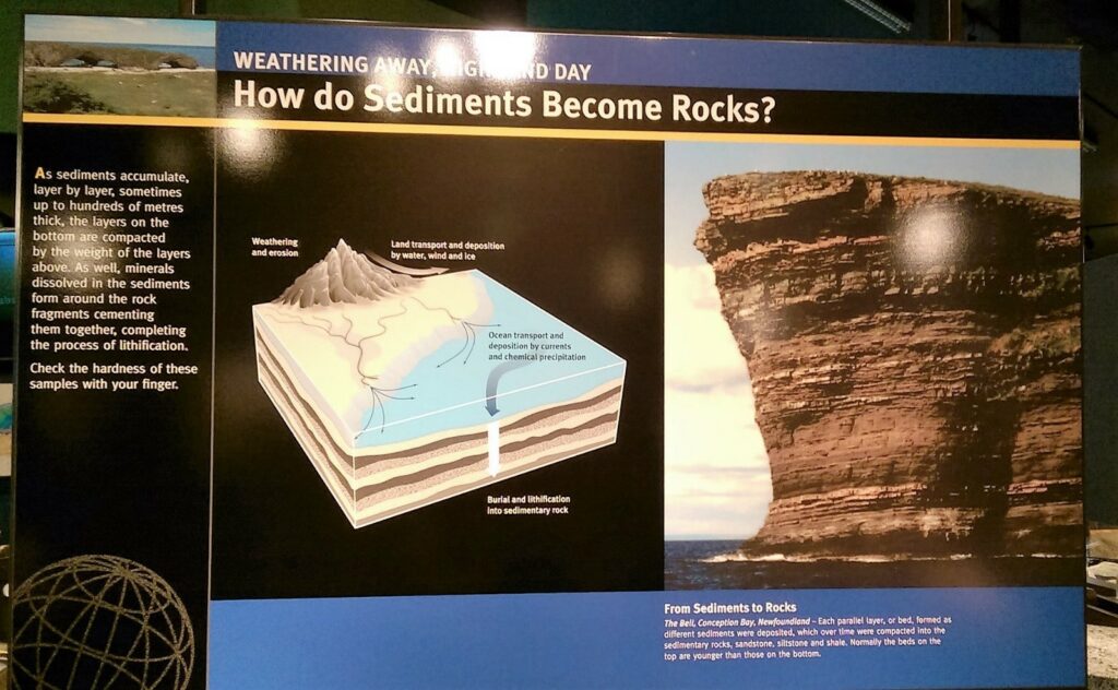
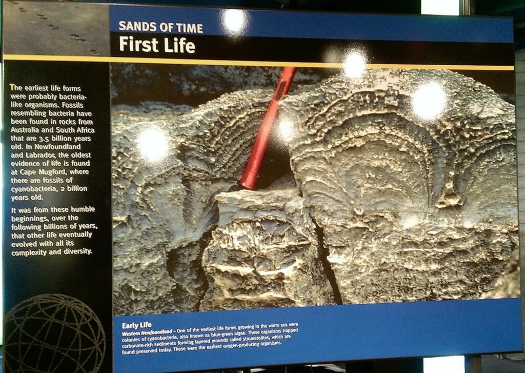
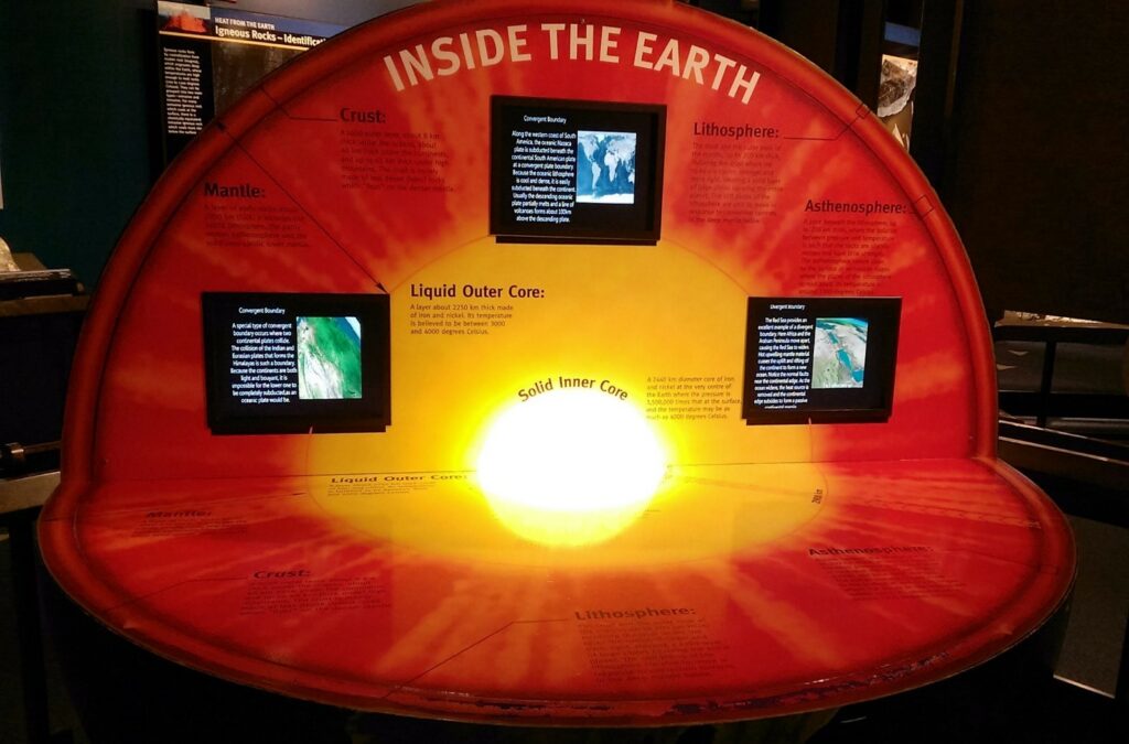
An especially informative topic for an Australian visitor concerns ‘Ice Age Migration’ – this explains how the first people arrived in the northern-most parts of the North American continent after the last massive ice age some 18,000 years ago. Before the rising oceans made the migrations impossible, humans crossed over the submerging land that connected Siberian with North America and travelled south across the Canadian shield, across central America and ultimately into South America. The display reports that “DNA analyses have confirmed the very close relationship between American Aboriginals and the Chukchi of Siberia”. One poster detailed the specific characteristics of the first settlers in Labrador and Newfoundland, and their use of a range of rock types for hunting and various domestic purposes.
