
Author: Marita Bradshaw, Consulting Petroleum Geologist
Extract from National Rock Garden Newsletter No. 16, October 2018
Key geological events of the last 4 billion years have shaped Australia’s present day environment, economy and society. Below is a list of seven rocks that represent some of these crucial episodes with a focus on the geological units that have had major impacts on the economic and population history of the last 150 years. For more discussion of the geology and themes introduced here, please see Shaping a Nation: A Geology of Australia (Blewett, editor, 2012).
1. Paleoproterozoic Pilbara banded iron formations
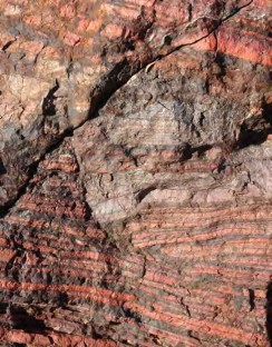
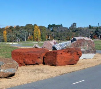
There is a long back story to Australia’s recent resources boom that starts in the Pilbara some 2.6 to 2.4 billion years ago when layers of iron rich sediments were laid down from an ancient ocean as the oxygen content varied with the activity of early photosynthetic organisms. Today, iron ore provides a sixth of Australia’s export income and once remote mines in the northwest are tethered by railways and ports to global supply chains for steel production (Office of the Chief Economist, 2018). The activity of early life over 2 billion years ago has built wealth for Australia and contributed to industrial growth in north Asia. The Federation rocks at the NRG include two big beautiful red blocks of Brockman Iron Formation from Hamersley Range donated by Fortescue Metals Group and the Government of Western Australia.
2. Paleoproterozoic Broken Hill ore body
The zinc-lead-sliver lode outcropping at Broken Hill, in far western NSW, is one of the many mineral deposits formed between 1760 and 1500 million years ago during the assembly of the cratonic blocks that form the older western and central parts of the continent. Other examples include the Mount Isa lead-zinc-silver ore body, and the Olympic Dam copper-gold-uranium deposit. Many such finds have been important in establishing cities and towns in the Outback and in providing wealth, but Broken Hill has been especially influential in shifting Australia from an agricultural to an industrial society. The rich mineral lode was discovered in 1883, in 1885 the Broken Hill Proprietary Company was formed, and in 1892 there was the first of several major miners’ strikes. The 1919 Great Strike eventually resulted in improved safety conditions and a 35-hour working week and BHP remains one of Australia’s largest companies, though it ceased operations at Broken Hill in 1939.
The Oorlano Metasomatite, from Wallaroo, donated by the South Australian Government to the NGR, is a representative of the Paleoproterozoic mineralisation interval. The original sediments were deposited 1760 million years ago and then altered around 1575 million years ago in the same geological event that formed the Olympic Dam orebody.
3. Early Paleozoic gold-bearing metasediments, Victoria
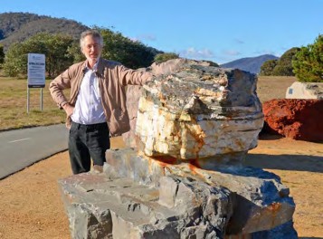
Step forward a billion years and the edge of the Australian continent had shifted eastwards with the accretion of island arcs, continental slivers and thick sediment piles in back-arc basins. One of these, the Castlemaine Basin, hosts the rich gold deposits of central Victoria formed as the sediments were folded, metamorphosed and injected by mineralising hydrothermal fluids. The discovery of gold in 1851 in Victoria changed the trajectory of Australia bringing a major jump in immigration and significant economic benefits. In 1852 the mining sector, led by the Victorian gold fields, contributed 35% of Australia’s GDP and over the next three years the population of Melbourne trebled. Political tensions grew with these sudden changes, the 1854 Eureka Rebellion over miners’ license fees took at least 27 lives but hastened the development of Australian democracy; and in 1856 Peter Lalor, the injured rebel leader (minus an arm) was elected to the Victorian parliament.The Federation rocks at the NRG include examples of Bendigo metasandstone & Ballarat quartz donated by the Government of Victoria, Unity Mining and Castlemaine Goldfields.
4. Permian Coal Measures—Sydney, Gunnedah and Bowen basins
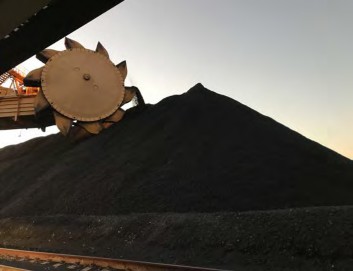
Australia and other parts of Gondwana (South America, Africa, India, and Antarctica) accumulated thick coal deposits in high latitude peat-swamp forests after the late Carboniferous early Permian glaciations. In eastern Australia, behind the convergent margin of eastern Gondwana, the Sydney-Gunnedah-Bowen foreland subsided and allowed the accumulation thick peat beds that, with later burial, were converted to large seams of high quality black coal. Coal was found outcropping along the Hunter River near Newcastle (1797) and the Brisbane River, in the early days of colonial settlement. Location close to surface and nearby the major population centres lead to coal becoming Australia’s major energy resource, it currently generates the most of our electricity and contributes more than 14% of export income (Austrade, 2017). Energy captured by ancient Gondwanan forests helps keep the lights on and fires steel-making furnaces around the world.
5. Triassic sandstones
The Triassic section in many parts of the world is characterised by sandstones deposited in deserts, alluvial plains and deltas across the supercontinent of Pangea. Australia’s biggest city Sydney is built on one such unit, the Hawkesbury Sandstone, which shapes its iconic landscapes and preserves the engravings and labours of indigenous and later cultures. Thick Triassic sandstones are also found on the other side of the continent, deposited in deltas that built out into the Carnarvon, Browse and Bonaparte basins that now underlie the North West Shelf. The gas in these sandstone reservoirs now represents more than 80% of Australia’s conventional gas resources and supports a major export LNG industry. The Federation rocks at the NRG include a large block of Hawkesbury Sandstone donated by the Government of New South Wales.
6. Cretaceous marine shales
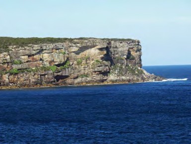
The last major marine flooding of Australia occurred in the Aptian and Albian Stages of the Cretaceous Period, around 125 to100 million years ago. About half the continent was inundated with the sea holding sway from the Gulf of Carpentaria to South Australia and from the Great Australian Bight to the North West Shelf. Fine grained marine muds and silts were deposited across vast areas and with burial under later sediments compacted to claystones and shales. These low permeability units now seal many of the gas and oil fields on the North West Shelf and in the Eromanga Basin in central Australia. Cretaceous marine shales, in particular the Rolling Downs Group, are also a major aquitard in the Great Artesian Basin, confining groundwater resources that can be accessed by drilling to support the pastoral industry across the dry interior.
7. Southern margin Cenozoic limestones
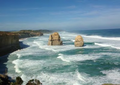
Eocene and younger limestones occur all along Australia’s southern margin, forming the Nullarbor Plain and spectacular coastal landscapes and extending far offshore in deposits kilometres thick. Calcareous skeletons of bryozoans, bivalves and foraminifera contribute much of the sediment deposited in carbonate shelf environments that extended far onshore during high sea level episodes in the Eocene and Miocene. These extensive limestones record the opening of the Southern Ocean and the separation of Australia and Antarctica, its last partner in Gondwana, as the island continent formed. They represent Australia’s long isolation which has been so influential in shaping our flora and fauna and history.
There are notable absences from this list, such as the Golden Mile Dolerite from the Kalgoorlie district or the Latrobe Group sands that host the giant oil fields in Bass Strait; and consideration could be given to an eighth rock, the one we are making now in the ‘Anthropocene’. There are also many other ways to order the geology that are important to Australians beyond this narrow economic perspective. For example, the cratons, foldbelts and basins that are the actual building blocks of Australia; or the iconic rocks that record the rise of life (Strelley Pool Formation stromatolites from the Pilbara, Ediacara Member trace fossils from the Flinders Ranges) or the materials that represent the long human history on the continent (ochre from the Rumbalara Shale, central Australia; Skillogalee Dolomite quarried for grinding slabs near Lake Eyre). The National Rock Garden provides the space and opportunity to explore these and many other themes that link people to the geology beneath our feet.
References
Austrade, 2017. Trade and investment note, Australia’s export performance in FY2017, Dec. 2017. https://www.austrade.gov.au/News/Economic-analysis/australias-export-performance-in-fy2017
Blewett R.S, (ed.), 2012. Shaping a Nation: A geology of Australia, Geoscience Australia and ANU E Press, Canberra, 332–379. http://epress.anu.edu.au?p=194981


