Introduction
This limestone formed in warm, shallow, tropical seas when Australia was part of the Gondwana supercontinent. It contains occasional fragments of coral and shell. Outcrops of this rock along the Molonglo River gave the Canberra region its early European name of ‘Limestone Plains’. Most of these limestone outcrops are now covered by the waters of Lake Burley Griffin.

Geological overview
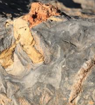
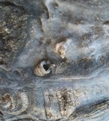
The Canberra limestone is a dark grey fossiliferous sedimentary rock deposited in warm shallow seas during the Early Silurian around 425 million years ago. The remains of corals and shells can be seen amid a finegrained dark matrix that was once a limy mud on the seafloor but has since been lithified and recrystallised into limestone.
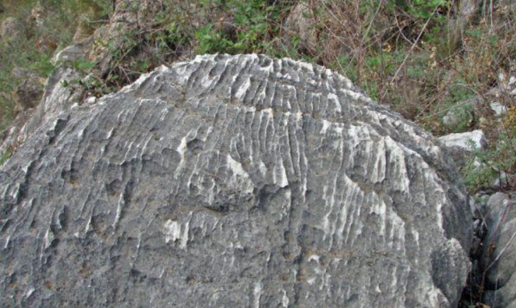
As with many other limestones, the Canberra limestone is susceptible to chemical weathering from rainwater which is acidic enough to slowly dissolve the calcium carbonate leaving solution features from a few centimetres across (rillenkarren) to cave systems many metres in extent.
The voids formed can be later lined with concentric rims of calcite crystals and filled with sediments and soils. Some of these features can be seen in the NRG’s specimen.


In the Silurian, Canberra was located near the convergent boundary of the Gondwanan continent and the global ocean of Panthalassa. What would become Australia was growing eastwards with the accretion of volcanic island arcs, continental slivers and thick sediment piles, and the intrusion of granite bodies from below. Here we have preserved a patch of the ancient seabed and evidence of some of the creatures from over 400 million years ago.
Canberra limestone can be seen ‘in the wild’ along the lakeshore further to the west near the National Museum of Australia at the Acton Peninsula, and it extends beneath Lake Burley Griffin across to southern shore where it has been intersected in the subsurface by drilling.
Did you know?
Subsurface beds of limestone, and associated caves, caused engineering problems for the foundations of many Canberra buildings, including the Treasury Building on the southern side of the Lake.
Indigenous context
The Canberra limestone occupied low areas in the landscape along the Molonglo River, a zone which was a natural pathway and provided important wetland resources (fish, water birds, reeds) for the Ngunnawal/ Ngambri and other indigenous people. Dams built on the river in the 1960s created Lake Burley Griffin, but also flooded Aboriginal rock art within the limestone caves below the Black Mountain peninsula.
Modern history and usage
Limestones lenses within the Canberra Formation are given the informal name of the Canberra limestone and it has also been known as the Acton limestone.
The Canberra Formation is a Silurian sequence of mudstones, sandstones and volcanics. In the early days of European settlement, these limestones were quarried to make quick lime, which was used as a mortar for building.
The Canberra limestone forms the low plains where people have gathered for thousands of years and now much of it is below the Lake, the stately water axis of the Walter Burley Griffin plan for the city.
Want to know more?
Geological Society of Australia website: ACT Sites & Maps https://www.gsa.org.au/Public/Geoheritage/ACT_Sites___Maps/Public/Geoheritage/ACT_Sites___Maps.aspx?hkey=f50b5b21-6074-4f24-9244-987c97f60e81
ANU Aboriginal and Torres Strait Islander Heritage Trail https://services.anu.edu.au/files/guidance/Aboriginal_Heritage_Trail2.pdf
The Friends of Black Mountain webpage https://www.friendsofblackmountain.org.au/sites/default/files/Symposium2018/01-Finlayson-BM-geology-Final-20Dec18.pdf
Jarvis, A. and Dunstan, J. Before ANU was here… ANU Reporter, Vol 47, no. 3. Last accessed 2 August 2022. https://reporter.anu.edu.au/anu-was-here%E2%80%A6
Butz, M., 1987. The lost karst of Canberra. ArchivesACT Research Guide. Paper presented at the 22nd Annual Conference of the Institutes of Australian Geographers, Canberra, 25–28 August 1987. https://www.archives.act.gov.au/__data/assets/pdf_file/0006/562596/Lost_Karst_of_Canberra_by_Mark_Butz.pdf
Author
Marita Bradshaw, National Rock Garden Steering Committee


